
Showcase gallery
Real flights. Real deliveries.
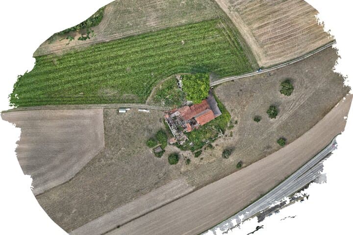
Each entry is a real drone job with the 1:1 outputs from our photogrammetric pipeline. Click in, spin the 3D model, scroll through the orthophoto — and see which calculator inputs would have produced the offer.

What you see in every showcase
Each entry shows the original delivery of a real job — the same files the client received, unchanged and viewable in the browser.
The references cover the services drone twins offers: drone surveying of plots and sites, volume calculation of landfills, stockpiles and gravel pits, drone inspection of roofs and building envelopes including damage assessment, and solar thermography with a finding per module. Each entry states the area, number of photos, number of points and the accuracy achieved.
The delivery formats are the same on every job: GeoTIFF for orthophoto and elevation model, LAS or LAZ for the point cloud, OBJ or glTF for the 3D model, and a PDF report with control points and residual errors. Client data appears only with explicit consent; confidential jobs are not shown here.
- Orthomosaic — the true-to-scale, rectified aerial image of the whole site
- 3D model — textured mesh of buildings and terrain, rotatable in the browser
- DSM/DTM — surface and terrain model for heights, slopes and volumes
- Point cloud — millions of georeferenced points for CAD and GIS
- Processing report — achieved accuracy, control points and camera calibration documented
Why real flights instead of demos
Stock examples show ideal conditions. Our showcases show what an RTK drone, ground control points and our photogrammetry pipeline actually deliver in wind, shadow and vegetation — including the accuracy achieved in centimetres. So you can check the quality before you request a quote.
Want this for your site?
Get a fixed-price estimate in two minutes — surveying, inspection or solar thermography. Same delivery as in the showcases.
Get a quote